

research // map making // infographic
Waring School is a small, private, school located in Beverly, MA. While dialoging with the school, it quickly became apparent that they were in need of a map for their campus, primarily to be distributed to visitors.

We began with a campus visit, both so we could meet the staff at Waring, and to familiarize ourselves with the school.
As first time visitors to this alternative school, we quickly discovered why a campus map would be beneficial. The campus is set off the beaten path, and difficult to find from the main roads. Additionally, on campus, many buildings have unique names and shapes. While this is representative of the fun nature of the school, it presents a challenge to visitors when trying to navigate the campus for the first time.

Forum building.
To begin the map making process, we took a look at Google maps. This helped us in understand how each of the buildings related to each other, as well as where the campus sits in relation to main roads.

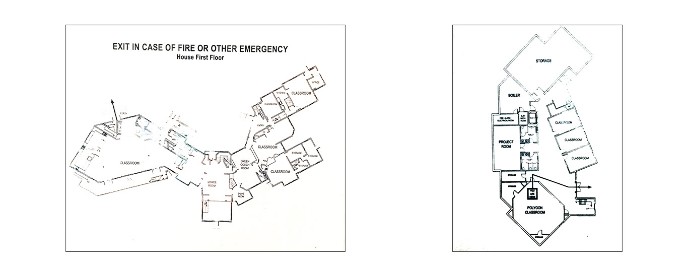
After our preliminary trace, we went back to Waring's emergency exit maps, so that we could more accurately portray the shapes of the buildings.
One of the larger challenges was deciding the level of information to include. From the athletic fields, to the nuances of the buildings, and spots of legend on campus, there was a lot of information to pair down, while still creating a map that felt true to the students and staff on campus.

Another challenging aspect of this creation was deciding how much of the campus to include in the final map. Waring School has an extensive piece of property, and there are many entrances. In theory a visitor on campus would not need a great level of detail of surrounding streets, but providing some context was necessary for orientation.
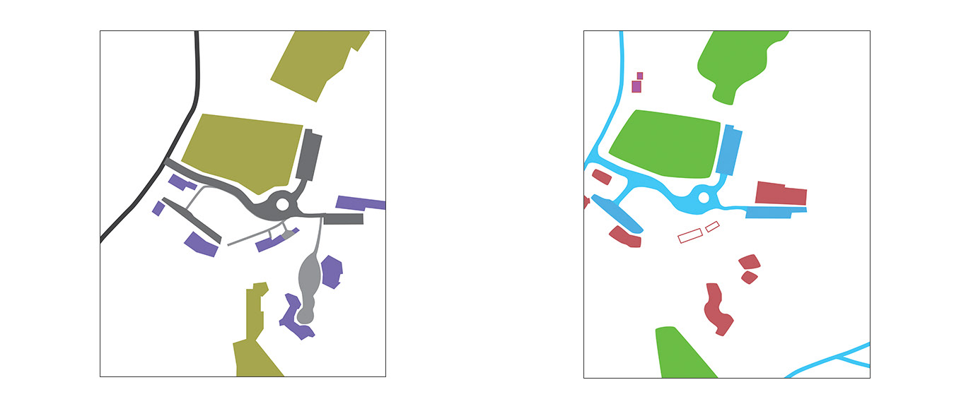
Experimenting with grass area shapes, level of detail in buildings, and the scope of the map.
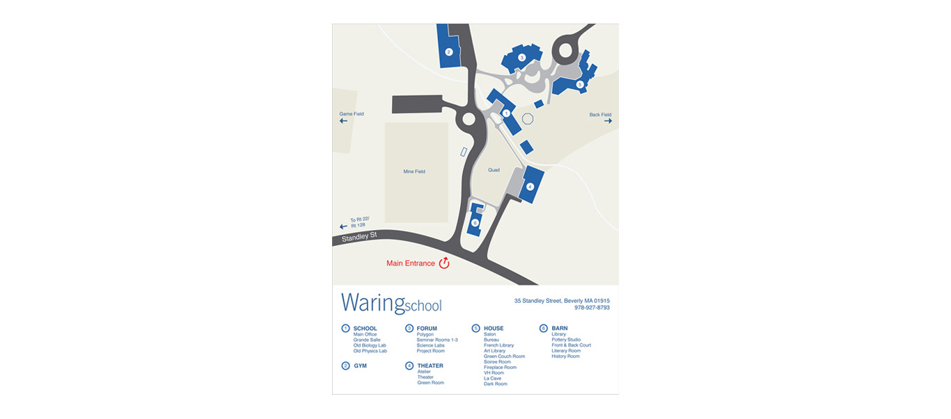
After many rounds talking with staff and students, walks around campus, and research into other campus maps, I was able to produce the below map for Waring School. The map feels true to the quirky nature of the campus while communicating information. The inclusion of the main entrance allows visitors to quickly orient themselves, and the detailed key at the bottom allows them to search for specific buildings.
While the school was thrilled with the production of the campus map, a point was brought up during the project that we needed to address. Waring School is set back a great ways from the main road, and there are a few back roads that visitors need to take. Additionally, they had often received calls from delivery agents not being able to find the entrance to the school. For this reason, we decided another map was necessary.
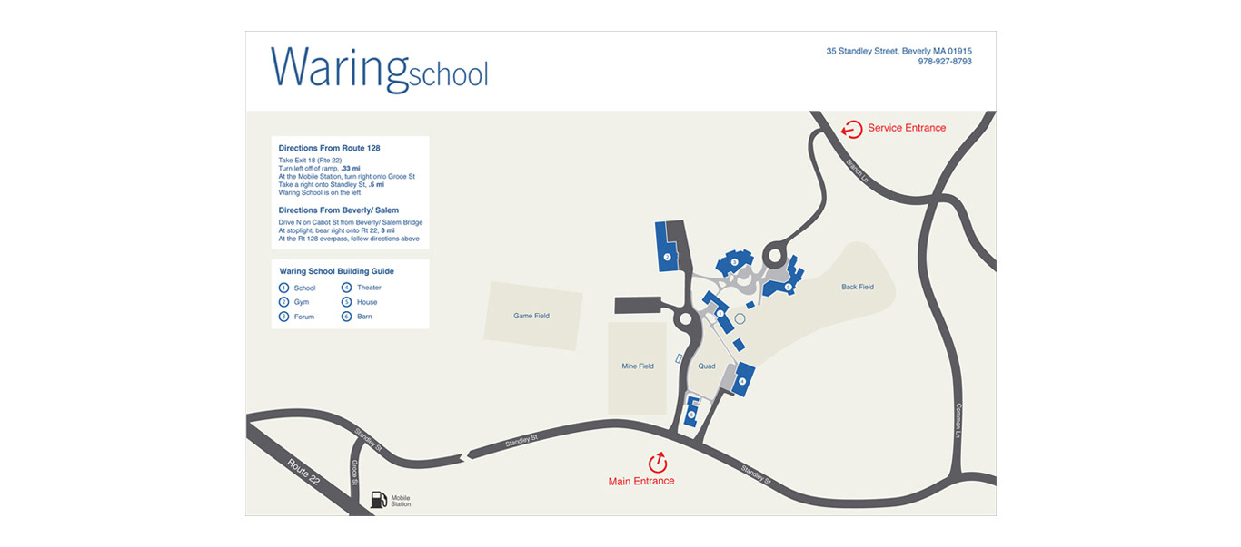
The map above was created for the purpose of helping visitors navigate to the campus. It provides a macro level of detail, assisting visitors in finding the entrances to the school, as well as the larger buildings. This was especially important for delivery trucks, as the service entrance is hidden on a very small back road.